Transportation and connectivity
Land use and transportation
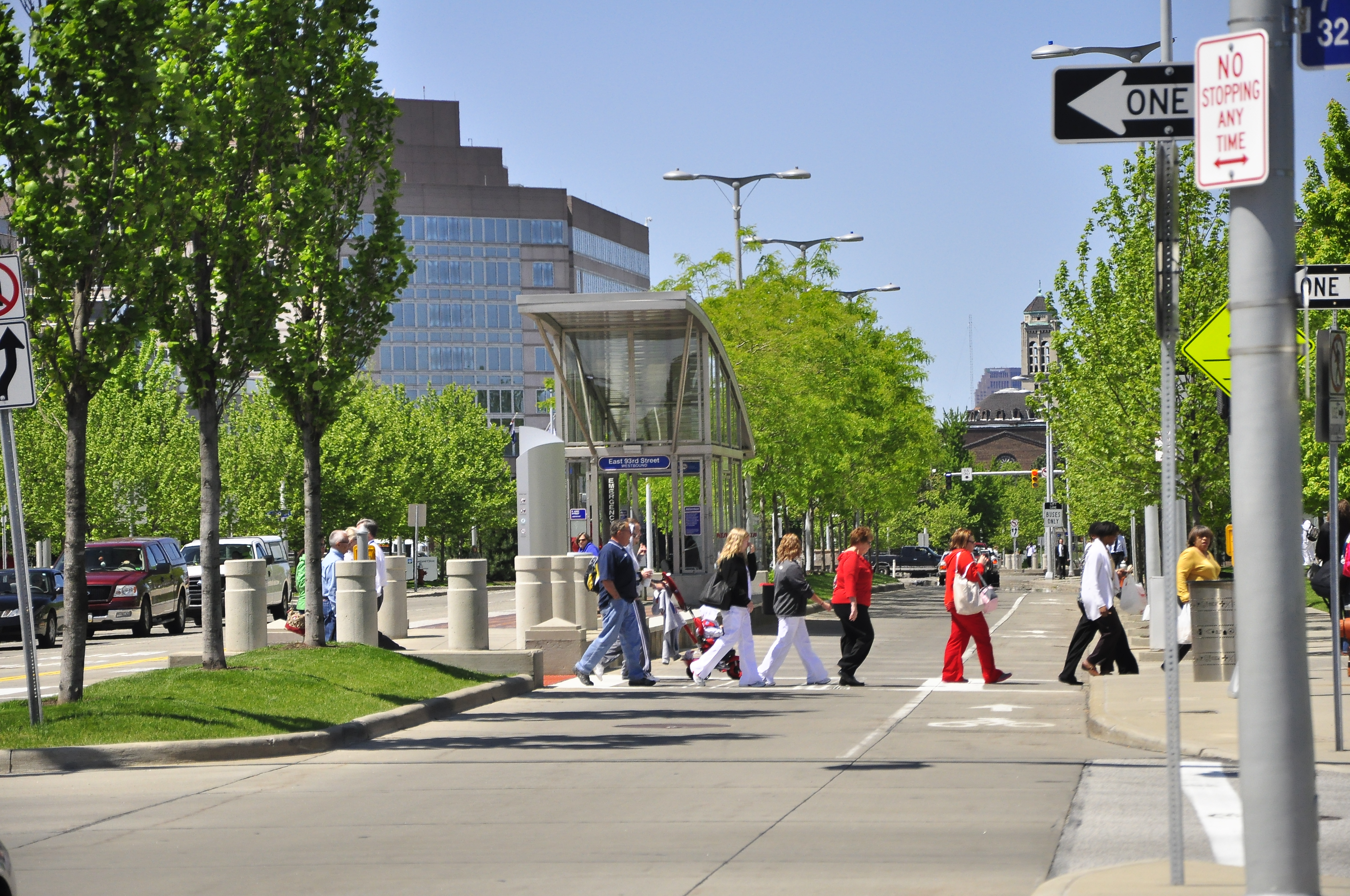
Walking, bicycling and high-capacity transit options must be integrated into a comprehensive network that provides San Antonio residents with multiple options for accessing residential, commercial, educational, cultural, healthcare and recreation opportunities throughout our city. In addition, this network must be coordinated and aligned with key land use objectives and investments that ensure a greater number of people live in close proximity to this range of multimodal options in the future. The City’s Complete Streets program, existing and planned linear greenway multi-use trails, and investments in regional centers should all be leveraged to achieve this goal. Our City must make a concerted effort to link regional centers with multimodal and transit corridors, providing multiple, non-automobile options for our residents traveling to and from work and other daily activities. Mobility within regional and urban centers is also important. Even if residents and employees must drive for some longer trips, many will choose other options for shorter trips that are easily reached by walking and biking. Expanded multimodal connections between and within employment and housing concentrations enhance our residents’ quality of life, increase access to employment and increases efficiency of our transportation system.
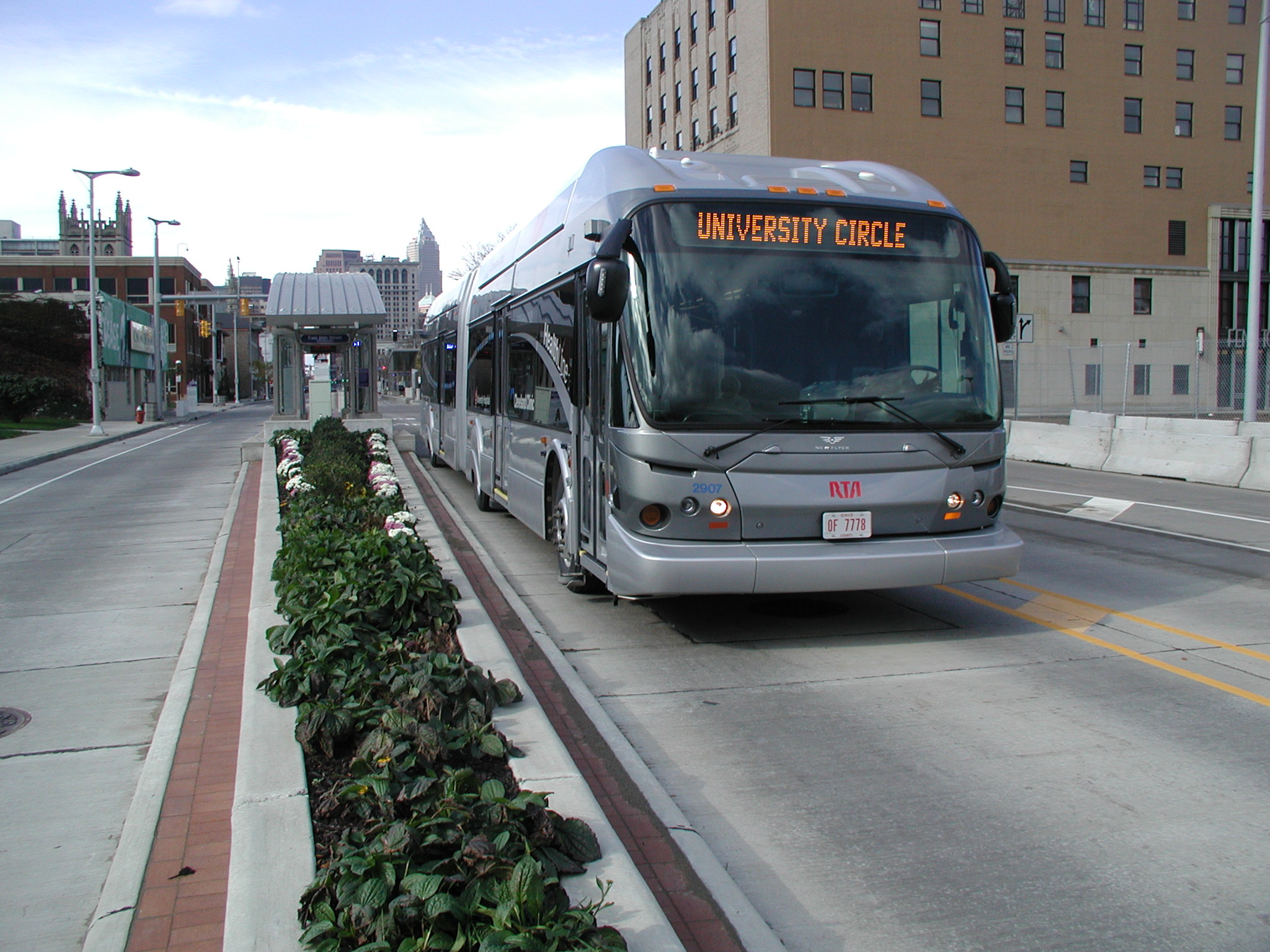
Connecting Regional Centers: Cleveland, Ohio
In 2008, the City of Cleveland completed the $197 million, 9-mile bus rapid transit (BRT) line, known as the HealthLine. The HealthLine connects Clevelands’s downtown to its health and education regional centers and its eastern neighborhoods along Euclid Avenue. With dedicated lanes, covered stations and electronic ticketing, the HealthLine has been instrumental in: spurring $5.8 billion in development along the Euclid Avenue corridor since 2008; increasing access to Cleveland’s medical, education and arts centers; and supporting the development of a multimodal network to compliment and support the BRT route. Considered one of the best US examples of BRT implementation, the scheme has generated $114.54 in economic development for each transit dollar spent and has seen a 60% increase in ridership over the old route. Significantly, a majority of the ridership growth has been in choice ridership – people who have a car but choose to ride public transportation.
Complete Streets
A Complete Street is a roadway planned, designed and operated to enable safe access for all users, including pedestrians, bicyclists, motorists and transit riders of all ages and abilities. There is no one type of Complete Street since roadways must serve different purposes for different land uses. Thus, Complete Streets are context-driven, with different components and amenities depending on the community served. While all Complete Streets are designed to accommodate all modes of travel in a safe, accessible and comfortable manner, they can be tailored to best serve the needs of surrounding communities, both existing and planned.
Linear Greenway Trails
San Antonio is developing a world-class system of bike paths and trails through the linear greenway parks, which provide routes for bicyclists outside of the street network. The City, in collaboration with other agencies, created paths along Leon Creek, Salado Creek, Medina River, and the Mission and Museum Reaches of the San Antonio River. Future plans include extending existing paths further along the waterways and creating new paths along greenways such as San Pedro and Alazán Creeks. This network of greenway trails connects us to a variety of important destinations, provides a direct connection to our treasured natural resources and offers safe and beautiful routes for commuting, recreational or visiting cyclists. In addition, this trail network is the basis for the unique Trail-Oriented Development place type illustrated in Chapter Six. Finally, strategic development of regional centers in San Antonio represents the city’s best opportunity to absorb and leverage projected population and employment increases while preserving the existing fabric of neighborhoods. These regional centers are one of the main Building Blocks of our city’s future. Each is at a different stage of development and offers unique potential in terms of combining land uses and multimodal connectivity. We must focus our efforts on carefully considered regional center plans that link existing and emerging land uses with our investments in walking, biking, and transit.